Flow-Cam
November 2019. Marco Spodek (community lab technician, Bard Environmental and Urban Studies Program) and Sebastian Grimm (graduate student at Bard’s Center for Environmental Policy) took two different voyages with a research group from Lamont Doherty, studying the micro-zooplankton communities along an open ocean salinity gradient where the freshwater of the Mississippi River empties into the saltwater of the Gulf of Mexico. They brought along the Bard Water Lab’s FlowCam, an instrument used to identify and categorize microscopic organisms in the water. They expected to see differences in the microbial communities along a salinity gradient, because of the limiting nutrients (nitrogen, phosphorous, etc) that come out of freshwater systems from agriculture and other industrial inputs.
They specifically tracked a certain phytoplankton (cyanobacteria) as a reflection of nutrient runoff from deforestation and agriculture. A probe was deployed off the side of the boat which took measurements like conductivity and temperature at different depths in addition to taking grab samples which would later be run through the FlowCam. When samples were processed through the Flow Cam, the microbes were categorized and sorted. This data will help the Flow Cam detect and sort images of microbes on its own in the future. These microbes and abundances would later be correlated with their respective physical conditions to compare microbial communities across an open ocean salinity gradient.
The Bard Water Lab is also running FlowCam analyses on Saw Kill water samples.
Saw Kill Drone Imagery
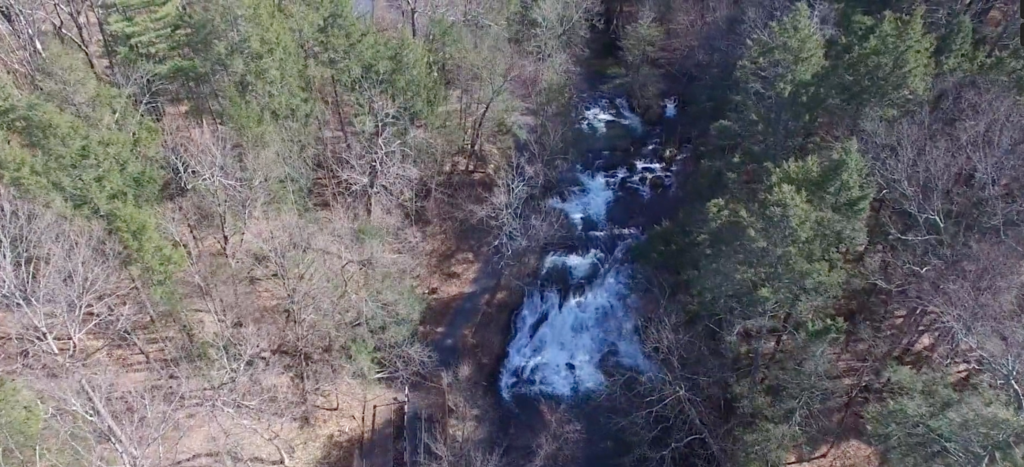
July 2016. This summer, we’ve been gathering imagery of the Saw Kill by using a drone with a high-definition camera attached to the bottom. John Maddox from Vertical Lift Visuals took many flights and eventually captured the entire river from multiple heights and angles in photos and videos. John has also been working on creating complicated three dimensional models of the river. An overhead visual survey allows community members and researchers to make more thorough observations than what would be possible on foot. Trees for Tribs and other environmental organizations could use the drone footage to monitor and maintain buffer zones. In addition, the footage can help us understand erosion patterns, water levels, plant life, and other nutrient indicators.